My last two posts have been about the location of the land belonging to my great-great-great grandfathers, Jacob Shelton (317.92 acres) and Levi Spikes (79.14 acres). Both were in Winn Parish, Louisiana, by 1860. Today I'm writing about the land of my great-great-grandfather, Levi Marion Shelton (1863-1941), Jacob's son, who married Levi's daughter Sarah Ann Spikes in 1884.
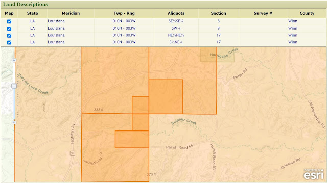
The process was the same as in the last two posts. First I used the United States Department of the Interior's Bureau of Land Management (BLM), General Land Office (GLO) Records Automation web site to find the location of Levi Marion Shelton's 1903 patent lands. On the patent details page, you could scroll down and use a mapping tool (checking the box in the Map column) to see just where Levi Marion Shelton's 157.11 acres were located (click on the image to view it larger):
I went to the State of Louisiana's Division of Administration Office of State Lands GIS & Data web page, and used the SONRIS Interactive Map linked there, choosing "Maps Historic 62.5k" as my background Imagery and using the Draw tool in the AOI Toolbox to draw lines on the map to roughly outline Levi Marion Shelton's patent. The result is the lighter green area below (click on the image to view it larger):
The background map, as discovered in my previous posts by exploring the United States Geological Survey's Historical Topographic Map Collection using a tool called topoView, was the 1950 Winnfield, Louisiana topo map, with a scale of 1:62500.
I grabbed a screenshot of the satellite image of this area from Google Maps, and used Microsoft Paint to outline Levi Marion Shelton's land. The result is below (click on the image to view it larger):
I found a final proof notice on page 5 of the November 22, 1901 issue of The Southern Sentinel (Winnfield, Louisiana), indicating Levi M. Shelton's intention to support his homestead claim on this piece of property. His witnesses includes L. E. (Levi) Drewett, who owned adjacent land; W. D. Drewett, who might be William Drewett, his nephew; and James Philan and Joab L. Durham, relatives by marriage.
On the oldest map I've been able to find (so far), the United States Department of Agriculture Bureau of Soils 1907 Winn Parish Soil Map, digitized by the University of Alabama, I zoomed in to the appropriate sections, grabbed a screenshot, and used Microsoft Paint to outline Levi M. Shelton's land, as well as that of his father Jacob Shelton and his father-in-law Levi Spikes. The result is below (click on the image to view it larger):
There are a couple small black squares (which mark buildings, such as houses) on the west side of Levi M. Shelton's property. Those were apparently gone by 1950. Levi Marion Shelton and his family had moved to adjacent Grant Parish by the time of the 1920 Census.
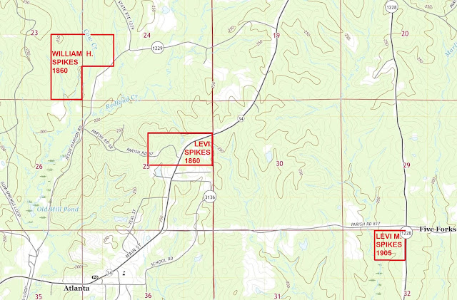
I also mapped the properties on the 2020 Atlanta, Louisiana topographic map, with a scale of 1:24000, to see roads and features as they appear in more modern time. The result is below (click on the image to view it larger):


